Shandong Fengtu IOT Technology Co., Ltd
Sales Manager:Ms. Emily Wang
Cel,Whatsapp,Wechat:+86 15898932201
Email:info@fengtutec.com
Add:No. 155 Optoelectronic Industry Accelerator, Gaoxin District, Weifang, Shandong, China


Sales Manager:Ms. Emily Wang
Cel,Whatsapp,Wechat:+86 15898932201
Email:info@fengtutec.com
Add:No. 155 Optoelectronic Industry Accelerator, Gaoxin District, Weifang, Shandong, China
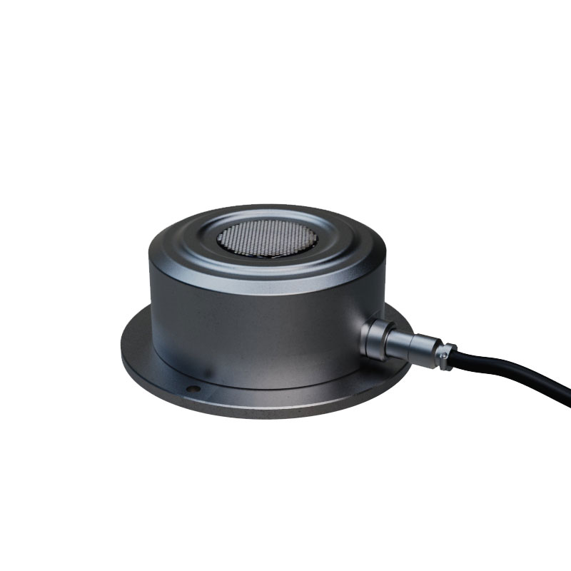
Model:FT-XL2
Brand:fengtu
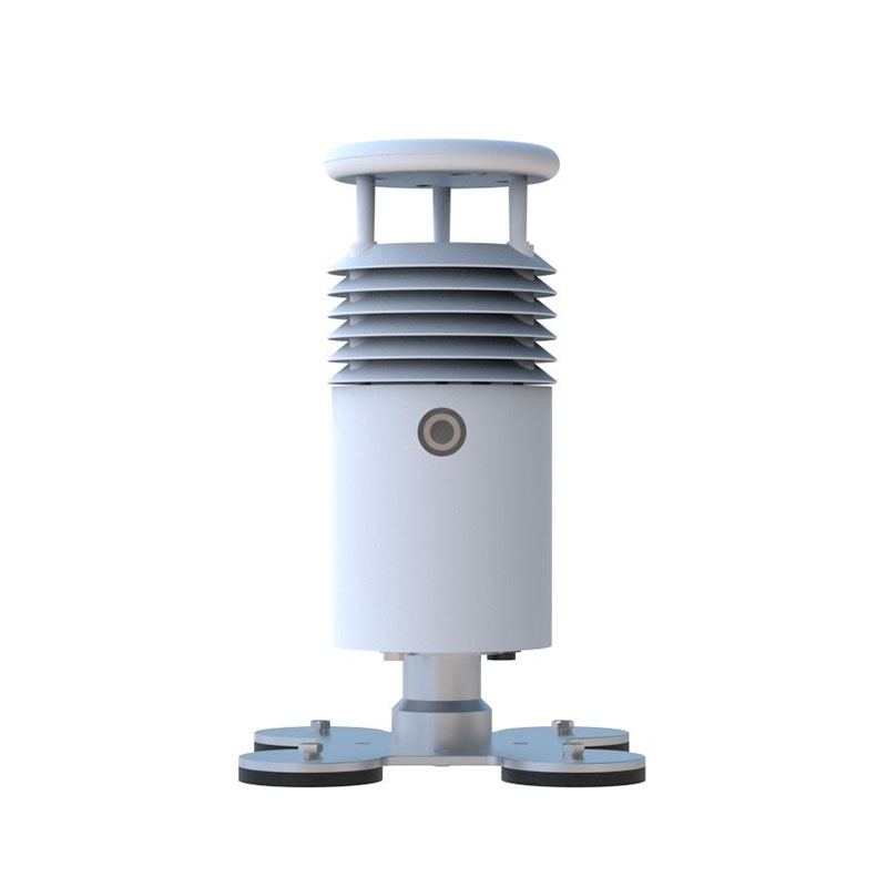
1.Ultrasonic Snow Depth Sensor Product Introduction
Ultrasonic Snow Depth Sensor is a sensor that uses ultrasonic technology to detect the distance to the snow surface. The sensor adopts an integrated capacitive electrostatic transducer probe design with high sensitivity, strong anti-interference ability and high accuracy.
2. Ultrasonic Snow Depth Sensor Technical Specifications
Power supply: DC12V
Working environment: -40-60℃, humidity ≤100% without condensation
Communication interface: RS485
Working current: 18mA DC12V
Minimum data interval: 0.2S
Shell material: aluminum alloy
Measuring range: 0-2000mm
Measurement resolution: 1mm
Accuracy: 1mm±0.2%
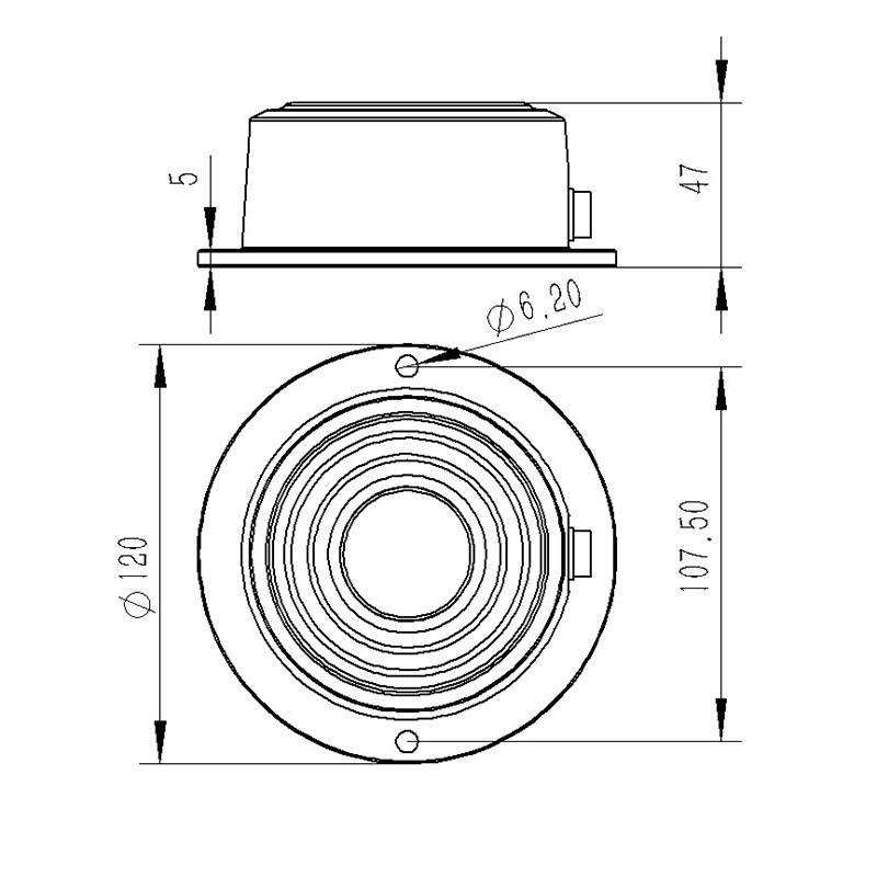
3. Ultrasonic Snow Depth Sensor Product Dimensions
4.Use of Ultrasonic Snow Depth Sensor
The equipment installation site should be selected in an open area.
The equipment installation cross arm should be at least 1M
There should be no obstructions above the device.
The distance between the device and the ground plane should be within 20cm-200cm. To ensure measurement accuracy, the recommended distance is 100cm.
The equipment mounting bracket should be kept horizontal. The reflective ground of the sensor should be level. The reflection point should be within a radius of 1 meter to avoid interference from weeds.
In the audit of highway construction projects, the construction quality and operational status of highway projects have always been the top priorities of inspection. Traditional audit inspection methods, such as drilling and coring inspection, have many drawbacks that cannot be ignored. The inspecti...
Drones are capable of accurately measuring wind, and the FT-F1 Anemometer for drones achieves this by utilizing the principle of ultrasonic resonance.Specifically, the instrument emits two fixed-frequency ultrasonic waves in the direction of the wind. Due to the influence of the wind speed, there wi...
Anemometer for drones is a device installed on unmanned aerial vehicles (UAVs) and is used to measure wind speed and wind direction. It can flexibly and efficiently collect atmospheric data in specific areas or at specific altitudes, and is applicable to fields such as meteorological research, envir...
In precipitation measurement, while rain gauges and tipping-bucket rain sensors enable convenient and accurate fixed-point observation, their coverage density is generally low in remote areas with sparse human population due to constraints on deployment conditions. This makes it difficult to effecti...


 Get a Free Quote
 Skype
Skype
 whatsapp
 mail
mail