Shandong Fengtu IOT Technology Co., Ltd
Sales Manager:Ms. Emily Wang
Cel,Whatsapp,Wechat:+86 15898932201
Email:info@fengtutec.com
Add:No. 155 Optoelectronic Industry Accelerator, Gaoxin District, Weifang, Shandong, China


Sales Manager:Ms. Emily Wang
Cel,Whatsapp,Wechat:+86 15898932201
Email:info@fengtutec.com
Add:No. 155 Optoelectronic Industry Accelerator, Gaoxin District, Weifang, Shandong, China
time:2022-09-20 17:18:38 source:Weather Station viewed:1264 time
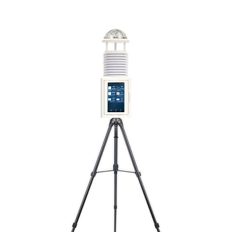
Water and Rain Monitoring System
Water and rain conditions are important hydrological reference materials and are of great significance in regional water resources allocation and management. It refers to the water and rain conditions, and the specific index parameters are water level, flow rate, flow, rainfall, rainfall intensity and so on. With the rise of the Internet of Things and technologies such as radar and wireless networks, these data can be measured by automated instruments, such as today's protagonist - the water and rain monitoring system.
The water and rain monitoring system consists of a sensor unit (sensor), a data transmission module (RS485, GPRS, etc.) and a data processing platform, which can realize real-time online detection and automatic alarm functions, and upload the monitoring data to the server for analysis and processing, so as to achieve accurate Control of water and rain data in the entire basin. The system is mainly used for river water volume prediction and forecasting on the main stream of rivers; optimization and control of water quality in small and medium-sized reservoirs; development and utilization of groundwater resources; water conservancy project construction safety early warning, etc.
The water and rain monitoring system has a certain degree of understanding of the flood characteristics in different regions, providing a scientific basis for flood control decision-making, and at the same time, it can timely reflect the local flood control situation to the relevant departments, and play the role of "one report with multiple capabilities".
The advantages of the water and rain monitoring system are as follows:
1. Using wireless transmission, the communication distance is short, the transmission efficiency is high, and it is not limited by environmental conditions, which can meet the needs of various complex applications
2. Simple equipment, easy installation and low maintenance cost
3. Strong anti-interference ability, strong anti-strong wind ability
4. Easy to deploy, affordable, automated operation, no need for human on-duty
5. Convenient for remote monitoring
The water and rain monitoring system has a wide range of applications, including river management, water supply planning, water conservancy construction, urban emergency rescue, forest fire prevention, soil and water conservation, environmental protection, urban drainage and waterlogging prevention, water pollution prevention and other fields. use.

Drone-based meteorological environment monitoring is flexible and efficient, capable of reaching areas that are difficult to access with traditional monitoring methods. The FT-F3 meteorological sensors for drones are professional meteorological monitoring devices tailored for drones.The design of FT...
In today's booming tourism industry, the installation of scenic weather stations in scenic areas has become a crucial measure to enhance the level of operation management and the tourist experience.From the perspective of enhancing the tourist experience, the weather warning function of the scen...
Agrometeorological stations are small automatic weather stations deployed in farmlands, orchards, greenhouses and other areas. They automatically monitor climate and environmental factors closely related to agricultural production activities, helping farmers and researchers grasp field environmental...
Agricultural Environment Monitoring System is a field environmental monitoring equipment composed of five parts: meteorological sensors, data collector, solar power supply system, pole support, and cloud platform. This system features easy installation and rapid deployment, automatically collecting and remotely transmitting environmental data such as temperature and humidity. It is widely used in agriculture, forestry, and scientific research....


 Skype
Skype
 whatsapp
 mail
mail