Shandong Fengtu IOT Technology Co., Ltd
Sales Manager:Ms. Emily Wang
Cel,Whatsapp,Wechat:+86 15898932201
Email:info@fengtutec.com
Add:No. 155 Optoelectronic Industry Accelerator, Gaoxin District, Weifang, Shandong, China


Sales Manager:Ms. Emily Wang
Cel,Whatsapp,Wechat:+86 15898932201
Email:info@fengtutec.com
Add:No. 155 Optoelectronic Industry Accelerator, Gaoxin District, Weifang, Shandong, China
Model:FT-CS120+
Brand:fengtu
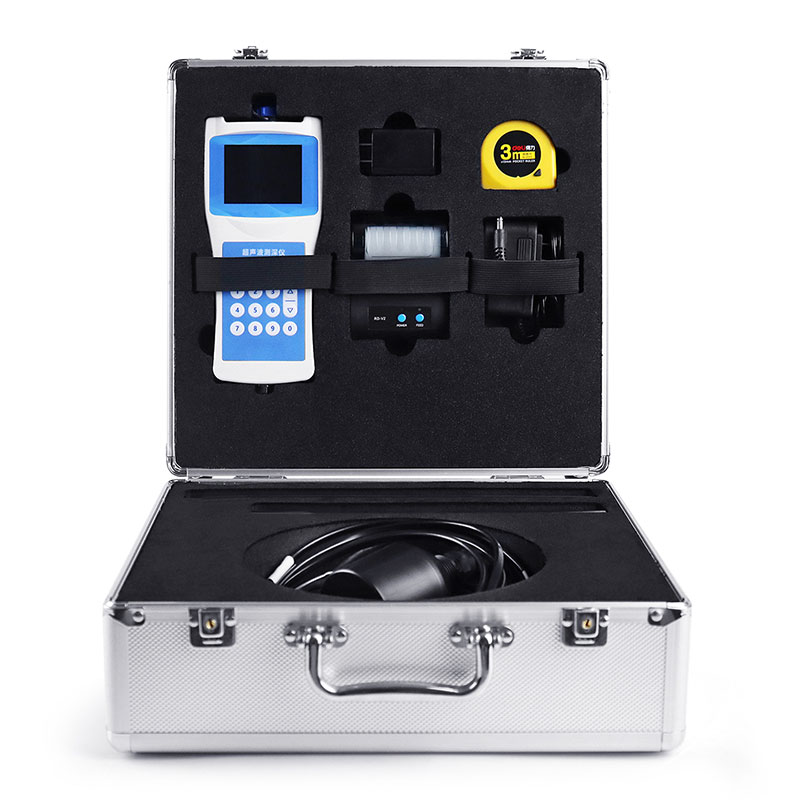
1、Water Depth Sounder Product Introduction
Water Depth Sounder is a portable depth sounder for measuring water bodies such as reservoirs, lakes, rivers, and shallow seas. To measure depth, an ultrasonic transducer is placed at a predetermined position below the water surface. Using the fixed velocity of ultrasound in water (V) and the time between transmission and reception (T), the instrument automatically calculates the water depth (H). This convenient and versatile handheld ultrasonic distance meter was developed by our company, drawing on years of production experience and the strengths of various similar products. The ultrasonic transceiver and converter circuit utilizes a dedicated large-scale integrated circuit (LSI) with a 99% component placement rate. The LCD displays the depth measurement results, ensuring long-term reliability while minimizing power consumption. The instrument offers precise measurements, low power consumption, high reliability, ease of use, simple operation, accurate measurement speed, and portability. It can measure depth in both still and swift water, with water velocities ≤ 5 m/s. It is an ideal depth measurement instrument for hydrological surveys, hydropower plant reservoirs, lake and river surveys, and environmental water monitoring.
2、Water Depth Sounder Technical Features
For external (inboard) installation on medium and small boats, with a 10-meter cable.
Simultaneously displays water depth, water temperature, latitude and longitude coordinates, travel speed, time, date, battery status, and Bluetooth connection status.
Self-stabilizing measurement technology and fast tracking technology provide real-time measurement results.
Built-in watchdog circuit ensures reliable and stable operation over long periods of time.
High-precision clock with an annual error of 3 PPM.
Storage utilizes a 16MB FLASH analog USB drive, allowing direct data access from a computer via a USB cable.
Automatically stores data in CSV format using the FAT32 file system.
High-brightness display for clearer field measurement data.
Beidou GPS dual-mode positioning displays real-time latitude and longitude, as well as ground speed.
Printer-free data printing via Bluetooth connection.
RS485 data output allows direct data access from a host computer, extending communication range.
Automatically adjusts echo sampling threshold, transmit power, and amplifier gain.
3、Water Depth Sounder Technical Parameters
| Measurement principle | Ultrasonic ranging method |
| Range of measurement | 0-120 meters |
| Blind spot | ≤0.5 meters |
| Power | Transmission power 32 levels, automatic gain adjustment |
| Minimum display resolution | 0.1mm |
| Precision | ±0.5%×full scale |
| Display | Chinese LCD full color screen display |
| Working frequency | 200~2000KHz automatic adjustment |
| On-site set-up: | Complete by pressing the main key. |
| Calibration: | Factory calibration, can be calibrated on site |
| Output, storage | USB reads data, board flash automatically generates an EXCEL file for measurement data, maximum storage quantity 10000. |
| Working voltage: | Built-in battery, external charger |
| Keyboard: | Number keys |
| Material: | Host: ABS engineering plastic |
| Sensor: ABS engineering plastic | |
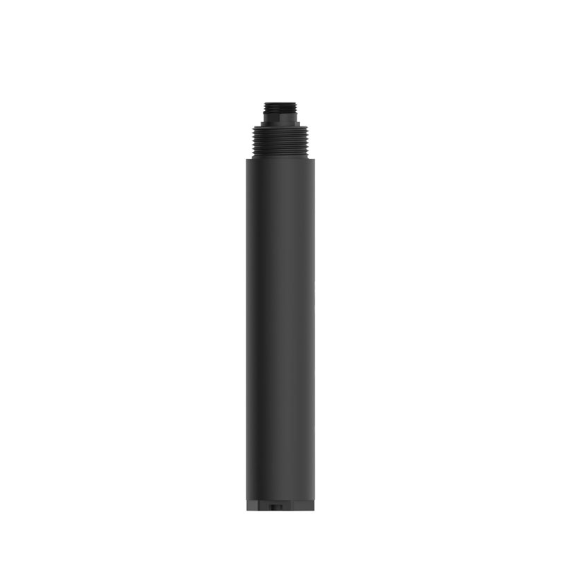
| Measuring rod: stainless steel, 2 pieces | |
| Weight: | Host: 330g |
| Sensor: 650~750g | |
| Sensor cable: | Diameter 5-10mm x 10m |
| Sensor ballast tube: | Length 53cm |
| Temperature measurement range: | -45℃~85℃ |
| Working temperature: | ≤80%RH no dew |
| Storage temperature: | ≤80%RH no dew-40℃~70℃ |
Handheld Weather Stations need continuous upgrades to better meet diverse meteorological monitoring needs. The FT-SQ6+ has been upgraded in multiple aspects compared to its predecessor, the FT-SQ5.First, it offers a richer set of measurement parameters. The FT-SQ6+ adds measurements of average wind...
With the development of science and technology, agricultural environment monitoring has become increasingly important.Traditional agriculture relies on manual work, which is time-consuming and error-prone; modern agricultural sensing data is single, lacking intelligent management and analysis, makin...
The Visibility detector launched by Fengtu is a high-precision measuring device based on the principle of forward scattering at 35 degrees. It determines the distance of visibility by measuring the scattering intensity of light by gas molecules, aerosol particles and other substances in the air. Thi...
In meteorological monitoring, accurate rainfall data is an important basis for the accuracy of weather forecasts. Traditional mechanical rain gauges have problems such as slow response, easy wear, and frequent maintenance, making it difficult to meet the needs of real-time and accurate rainfall moni...


 Get a Free Quote
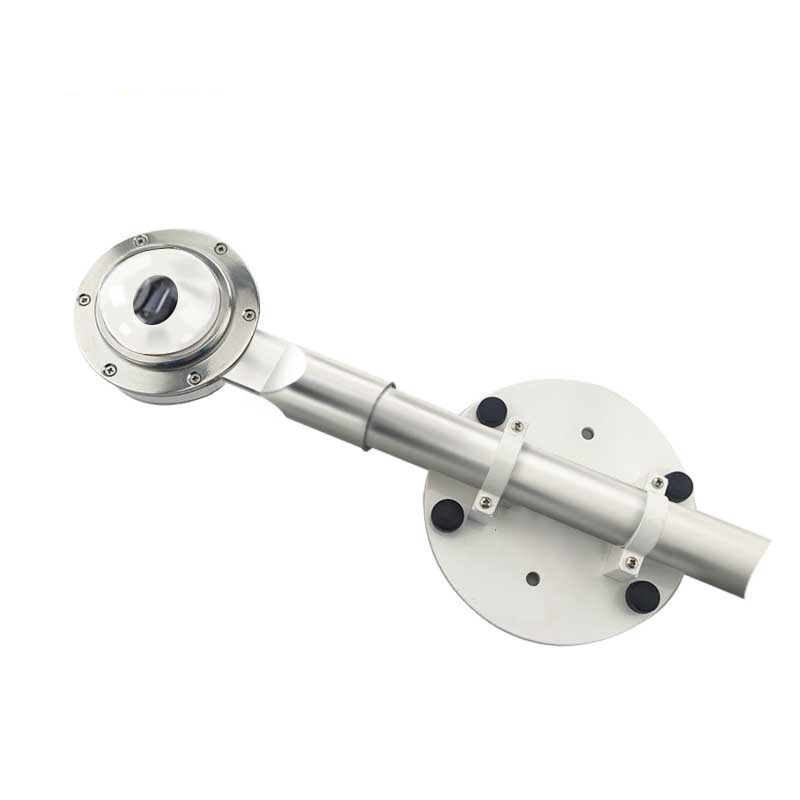
 Skype
Skype
 whatsapp
 mail
mail