Shandong Fengtu IOT Technology Co., Ltd
Sales Manager:Ms. Emily Wang
Cel,Whatsapp,Wechat:+86 15898932201
Email:info@fengtutec.com
Add:No. 155 Optoelectronic Industry Accelerator, Gaoxin District, Weifang, Shandong, China


Sales Manager:Ms. Emily Wang
Cel,Whatsapp,Wechat:+86 15898932201
Email:info@fengtutec.com
Add:No. 155 Optoelectronic Industry Accelerator, Gaoxin District, Weifang, Shandong, China
time:2025-06-17 09:40:52 source:Weather Station viewed:524 time
Low-visibility weather conditions such as fog, haze, precipitation, and sandstorms not only cause great inconvenience to travel but also frequently trigger major accidents, leading to severe casualties and economic losses. However, the existing Doppler weather radars in meteorological and environmental monitoring stations are insufficiently dense, suffering from limited coverage and increased detection errors with distance, failing to meet the needs of fine-scale detection. Radiosondes carried by sounding balloons for fixed-point observation cannot control their positions, have poor reliability, and are difficult to recover with high costs. While ground-based visibility detectors are widely used, high-altitude visibility observation equipment remains scarce. Against this backdrop, Uav visibility meters have been widely adopted, providing a new approach to obtain more comprehensive and accurate visibility data with advantages of flexibility, convenience, and wide coverage. Below are introductions to two Uav visibility meters.
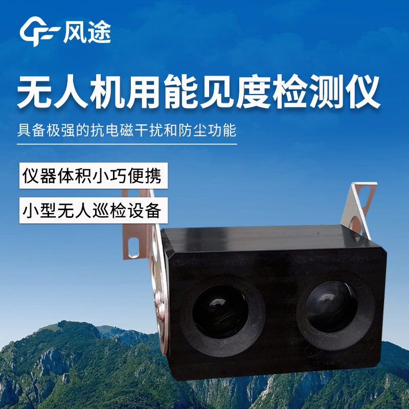
1. FT-WJN6: 6KM Forward Scattering Visibility Detector
Working Principle:
Using the forward scattering method to measure the total extinction coefficient of air and calculate the current visibility. The transmitter employs an infrared LED as the light source, which is pulse-modulated and irradiated onto the sampling space through a lens. Aerosol particles in the sampling space scatter the light, and the amount of scattering is related to the size and concentration of aerosol particles, which in turn correlate with atmospheric visibility. The scattering visibility meter determines the total scattering coefficient by measuring the scattered light intensity at a specific angle and calculates the visibility based on the relationship between this intensity and the total scattering amount.
Performance:
Detection range: 10 to 6,000 meters (maximum detection distance up to 10,000 meters), meeting visibility monitoring needs in different scenarios.
Measurement accuracy: ±10%, accurately reflecting actual visibility.
Operates normally at an altitude of 4,000 meters and -20°C. With a flat shape and low wind resistance, it can be mounted on the aircraft belly. Users can choose ABS or aluminum alloy casing materials and optional temperature-humidity and air pressure sensors.
Power consumption: Only 0.9W, suitable for small UAV platforms to reduce energy consumption and extend flight time.
2. FT-WJN4: 4KM Backward Scattering Visibility Detector
Working Principle:
Based on the backward scattering principle, it measures visibility by precisely detecting changes in atmospheric backward scattering energy and calculating atmospheric visibility values combined with corresponding mathematical models.
Performance:
Weighs only 110g, with dimensions of 94mm×69mm×42mm. Its miniaturized shape, low wind resistance, ultra-light weight, and ultra-low power consumption enable easy integration with small UAV platforms without significantly affecting flight performance or flexibility.
Strong anti-electromagnetic interference and dust-proof capabilities ensure stable operation in harsh environments (altitude 4,000m, -20°C), adapting to various complex climatic conditions and application scenarios.
Supports digital output modes such as RS485, RS232, and SDI12, with optional BLE5.0 Bluetooth output for convenient data communication with UAV flight control systems and other devices, ensuring real-time and efficient data transmission.
Detection range: 10–4,000 meters, covering the visibility range required for general meteorological and environmental monitoring. Measurement accuracy: ±15%, providing reliable data for subsequent decision-making and research.
Uses an IR LED light source with long lifespan, high stability, low energy consumption, and a response time of only 10 seconds, quickly reacting to visibility changes and outputting real-time data.
Mosquito Killing Lamp is an agricultural plant protection device that integrates physical pest trapping, intelligent pest monitoring, and remote data management. It utilizes a specific spectrum light source to attract pests, kills them with a high-voltage electric grid, and transmits pest data in real time using IoT technology, achieving precise monitoring and green control of pest populations....
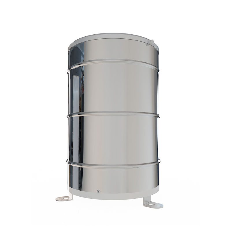
In meteorological observation and environmental monitoring, visibility is a key indicator, which is of great significance to traffic safety, navigation operations, and meteorological research. The Fengtu FT-N10A2 Visibility Sensor features a stainless steel body design, allowing it to be used with c...
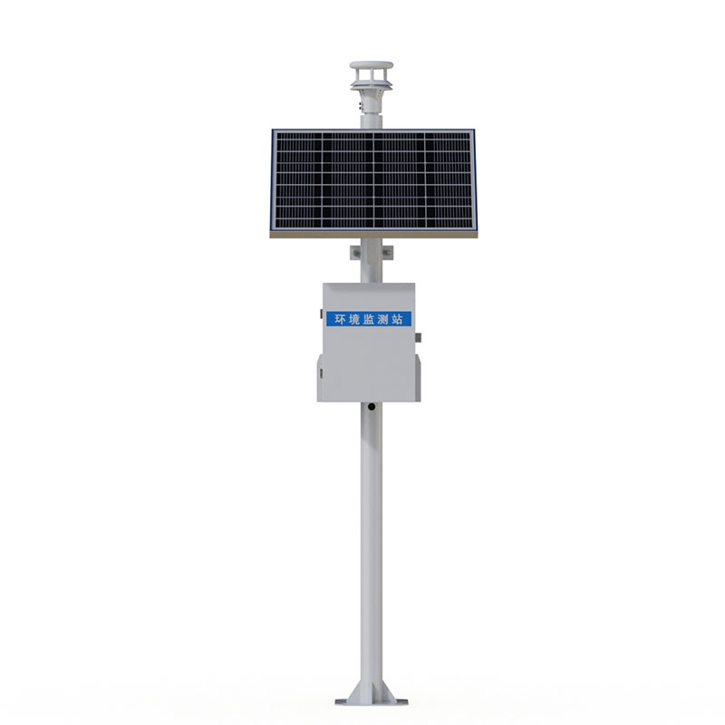
The compact weather station is a dedicated device focused on meteorological data collection. Characterized by easy installation, simple operation, high measurement accuracy, and integration of multiple meteorological elements, it is highly favored by meteorological researchers and has become their p...
In agricultural production, pest infestations restrict crop yield and quality. Traditional manual inspection-based monitoring is labor-intensive and time-consuming, with limitations such as a narrow coverage range and delayed data, making it difficult to provide accurate support for pest prevention...


 Skype
Skype
 whatsapp
 mail
mail