Shandong Fengtu IOT Technology Co., Ltd
Sales Manager:Ms. Emily Wang
Cel,Whatsapp,Wechat:+86 15898932201
Email:info@fengtutec.com
Add:No. 155 Optoelectronic Industry Accelerator, Gaoxin District, Weifang, Shandong, China


Sales Manager:Ms. Emily Wang
Cel,Whatsapp,Wechat:+86 15898932201
Email:info@fengtutec.com
Add:No. 155 Optoelectronic Industry Accelerator, Gaoxin District, Weifang, Shandong, China
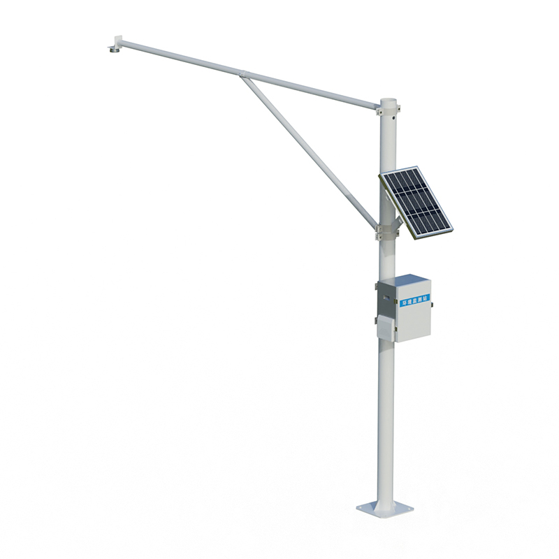
Model:FT-SW1
Brand:fengtu
1.River Level Monitoring Station product overview
SW1 is a fully automatic hydrological online monitoring system based on microwave technology, which can measure water levels in channels simultaneously.It uses advanced K-band plane radar technology to measure the water level of water bodies through non-contact methods, and calculate and output real-time water level data according to built-in software algorithms; it can be used for non-contact flow measurement in rivers, irrigation canals, underground drainage pipelines, flood prevention warnings and other occasions; the product has the characteristics of low power consumption, small size, high reliability and convenient maintenance; the measurement process is not affected by factors such as temperature, silt, river pollutants, and floating objects on the water surface.
2.River Level Monitoring Station Application Field
1.Water level measurements for rivers, lakes, tides, reservoir gates, groundwater pipelines, irrigation channels, etc.
2.Auxiliary water treatment operations, such as urban water supply, sewage discharge monitoring, etc.
3.Flow calculation, inlet and drainage flow monitoring, etc.
3.River Level Monitoring Station product features
1.Non-contact measurement, calculate flow in combination with cross-sectional parameters, and is not affected by wind, temperature, haze, silt, sand, floating objects, etc.
2.It is suitable for a variety of measurement conditions, and is not affected by corrosion and foam, and can output water level measurement data.
3.The water level uses a planar array radar antenna, with its own angle measurement function, the equipment is small in size and easy to install.
4.Convenient configuration software can easily configure parameters according to actual needs to adapt to different usage conditions.
5.Not affected by changes in water vapor, temperature and pressure in the atmosphere
4.River Level Monitoring Station Monitoring Platform
1.CS architecture software platform, supports direct observation of mobile phones and PC browsers without additional software installation.
2.Support multiple accounts and multiple devices to log in
3.Support real-time data display and historical data display dashboard
4.Cloud server and cloud data storage are stable and reliable, easy to scale, and load balancing.
5.Support SMS alarm and threshold settings
6.Support map display and viewing device information.
7.Support data curve analysis
8.Support data export table form
9.Supports data forwarding, HJ-212 protocol, TCP forwarding, http protocol, etc.
10.Support data post-processing function
11.Support external running of javascript scripts
5.River Level Monitoring Station Summary Indicators
Supply voltage: 100mA (operation), <1mA (sleep);
Working voltage: 12V power supply
Operating temperature: -35℃~60℃;
Storage temperature: -40℃~60℃;
Field protection level: IP68
Signal output: RS485/MODBUS protocol;
6.River Level Monitoring Station Technical Parameters
Water level measurement
Range measuring range: 0.1-40 meters
Range measurement accuracy: ±5mm
Range measurement resolution: 1mm
Interval time: 1-5000min
Power supply method: combined power supply of solar panels + battery
Solar power: 10W/30W (optional)
Battery parameters: DC3.7V 10Ah
Support height: vertical pole 3 meters cross arm 3 meters
Working environment: -45℃~85℃ (not freezing state)
7.Precautions for installing River Level Monitoring Station
1.Installation environment
There are no huge stones in the test channel blocking the water, no huge vortexes, turbulences, etc.
The test channel section should be straight, stable, and concentrated
The test channel section needs to be hardened, and the measurement section should be regular
The test channel section should be kept smooth to prevent floating objects from accumulating
2.Installation height
Recommended installation height 3-4 meters
The transmission line micro-meteorological online monitoring system is an industrial-grade meteorological monitoring device installed on power transmission towers. It uses a high-precision sensor array to collect meteorological parameters such as wind speed, wind direction, temperature, humidi...
The casing material of micro weather sensors significantly affects their performance and service life. Currently, ASA and ABS are common choices for micro weather sensor enclosures:ASA Material: Offers excellent weather resistance, effectively blocking UV rays to prevent fading and aging during long...
In the aviation field, weather conditions play a crucial role in the safe takeoff and landing of flights. The FT-N10 Present weather and visibility sensor adopts the 35° forward scattering principle. It uses an infrared LED light source to emit infrared light and determines the visibility distance...
Underwater Night Vision Goggle utilizes a high-performance third-generation image intensifier and is an electro-optical device specifically designed for observation and search in low-light or no-light underwater environments. It can effectively penetrate dark environments and accurately capture underwater details. Its main applications include underwater rescue in fire and emergency situations, underwater reconnaissance by armed police forces, underwater facility inspection for power companies, forest fire water source exploration, underwater evidence searching for police and public security, and underwater ecological monitoring for forestry and environmental protection....


 Get a Free Quote
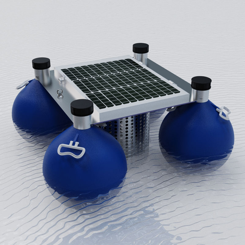
 Skype
Skype
 whatsapp
 mail
mail